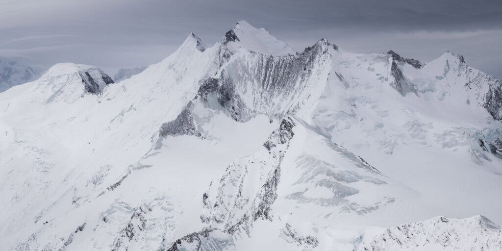
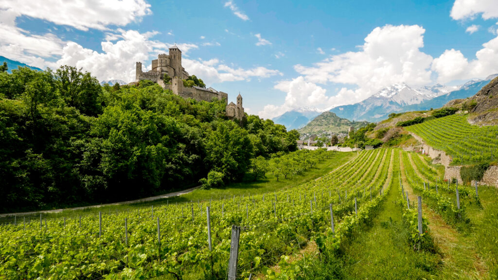
Above the Mattertal valley, a path winds its way through larch forests, alpine meadows and glaciers. The Europaweg links Grächen to Zermatt in a two-day walk and is considered the most beautiful hike in the Alps. The route is renowned for its panoramic views of the 4,000 Valaisans and its grandiose finish facing the Matterhorn. The hike totals around 40 km of trail, 2,550 m of ascent and 1,880 m of descent, with a commitment time of around 13 h 30, spread over two equivalent stages.
A spectacular crossing of the Charles Kuonen Bridge
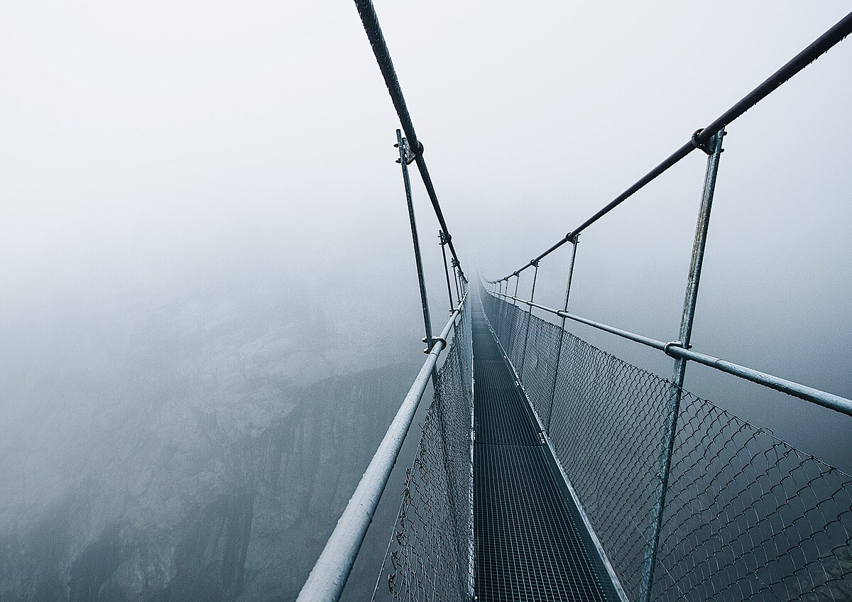
Between Randa and Täsch, the route passes over the Charles Kuonen suspension bridge: 494 m long, 85 m at its highest point, 65 cm wide, 53 mm-diameter suspension cables weighing 8 tonnes alone. Designed as a "monument to the mountain panorama", it lets nature take precedence: metal latticework and fine lines to float in the landscape. The crossing takes around 10 minutes - a timeless moment to contemplate the Weisshorn and the wild beauty of the valley.
When to go & trail conditions
- Season: the Europaweg is a mountain trail that is not passable in winter (the bridge is closed); it is usually open from late June to early October, depending on snow conditions.
- 2025: the route is partially opened; the Randa - Täsch section (Springelboden - Eggenstadel) is bypassed to the Täschgufer. From the Bärgji in Randa, you descend into the valley as far as Täsch, before climbing back up to Täschalp. Check the news before you go.
Level & markings: white-red-white mountain route, sometimes exposed passages (T3 or T4). Good fitness, mountain legs and stable weather are essential. Avoid the bridge in stormy weather.
Recommended 2-day itinerary
Day 1 - Grächen → Herbriggen → Europahütte (6 h 30 to 7 h 30 walking)
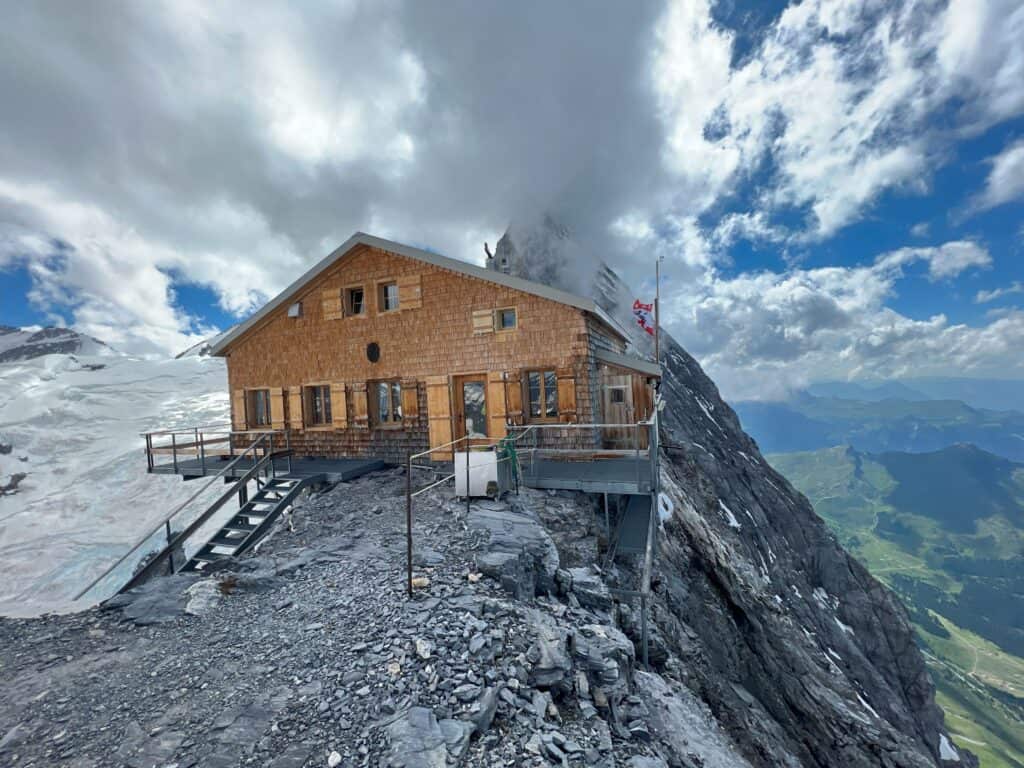
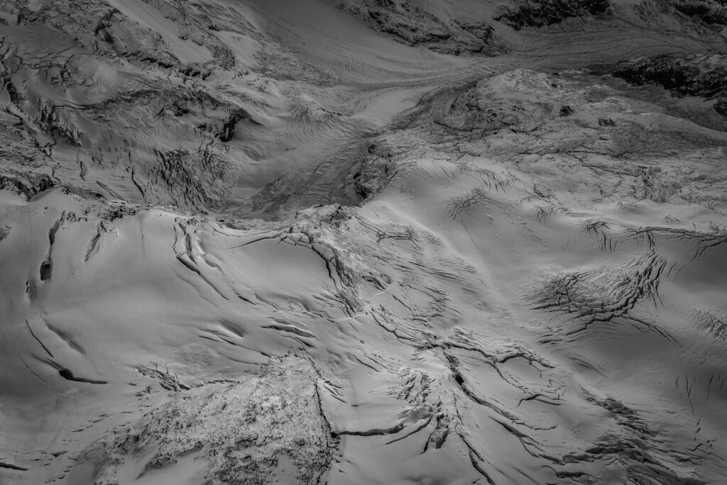
At dawn, the light glides over the alpine pastures; we take advantage of the morning freshness for the first descent of around 300 m to Herbriggen, before climbing up to the forest and mineral balconies that lead to the Europahütte (2,225 m). The hut is located above Randa, facing the glaciers.
Day 2 - Europahütte → Pont Charles Kuonen → Täschalp → Tufteren → Sunnegga (6 h to 7 h walk)
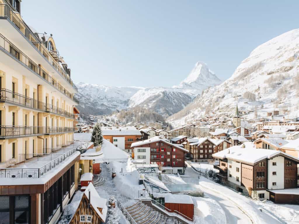
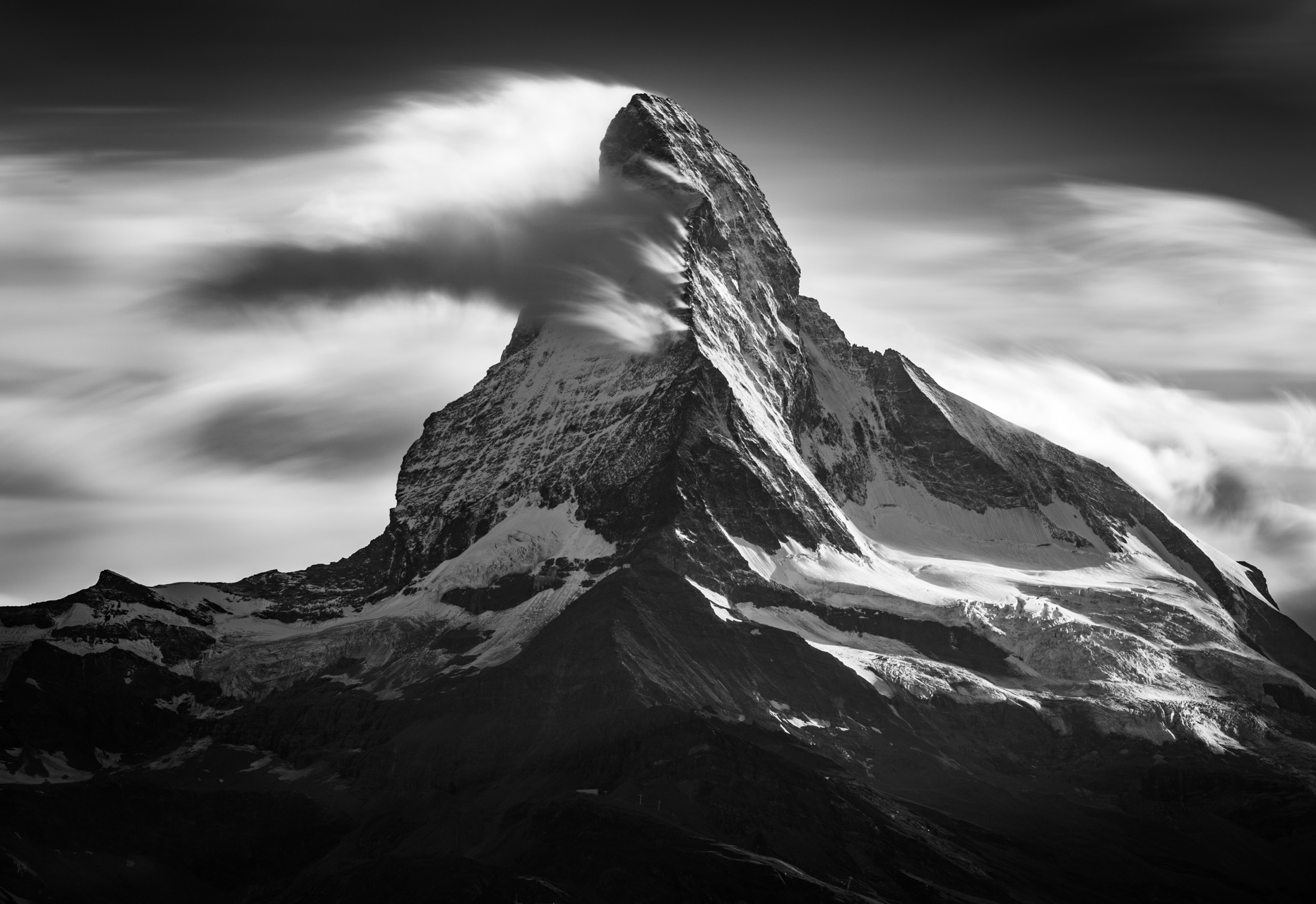
As soon as you've warmed up your step, you reach the bridge; the void opens up, the larch trees fade away, and your gaze changes. After the crossing, the path undulates towards Täschalp, then unfurls its panoramic curves via Tufteren and Sunnegga, where the Matterhorn becomes ever more imposing: our gaze rests on the magnificent north face and the ever more majestic Hörnli ridge. The final approach is one of pure contemplation: the pyramid rises above the pastures and we enter Zermattcarried away by its magnetism.
Variants to adapt your crossing
- In the direction Zermatt → Grächen: start with the Sunnegga train (1,620 m → 2,288 m) to swallow most of the ascent straight away. The view of the Matterhorn in front of you changes the whole dynamic of the route.
- Day loop from Randa (bridge only): an 8.6 km loop, ~4 h, ± 988 m ascent, perfect for discovering the bridge (possible detour to Europahütte).
- Short stage Randa → Europahütte: direct ascent (Haute Route itinerary) to sleep at the hut and enjoy the sunrise over the summits.
Europaweg: two days between heaven and earth
The magic of the Europaweg lies as much in the beauty of the scenery as in the crossing of the suspension bridge. From the bridge, the Weisshorn cuts like a blade; further on, the glacier overlooking Randa contrasts with the larch trees. Then, as we advance towards Täschalp and Tufteren, the path leads us to a breathtaking view of the Matterhorn. This itinerary is an invitation to wait for the perfect moment: when the mists open up, the clearings reveal the ridges, and the wind clears the horizon.

Practical advice & safety
- Difficulty: T3: sometimes exposed passages, uneven terrain, hands useful for balance in places. The route requires good physical condition. Remember to bring a pair of sturdy shoes and a pair of poles.
- Weather & water: leave early, take plenty of water (long sections without refreshments). Turn back if the skies threaten.
- Thunderstorms: do not use the footbridge in the event of a thunderstorm; the structure is metal and very exposed.
- Closures & detour: check the official Europaweg page the day before and the morning of; follow the Springelboden → Attermenzen → Täsch detour if it is maintained.
Access & logistics
- Train: to Visp, then take the Matterhorn Gotthard Bahn to St. Niklaus, Randa, Täsch or Zermatt. To Grächen, take the bus from St. Niklaus. For the bridge loop, depart directly from Randa station (≈ 3 h 30 from Zürich Airport, ≈ 4 h from Geneva Airport).
- Parking (Randa): Main parking lot at the railway station. Parking is also available at the church and at the "Gsteini" parking lot (tickets must be purchased at the tourist office). Street parking prohibited.
- Refreshments: sparse accommodation and restaurants; on the official route, Herbriggen and Täschalp are key points.
Quick facts
- Distance / Ascent: ~39 km, +2 550 m, -1 882 m.
- Typical stages: J1 Grächen → Herbriggen → Europahütte (6.5 - 7.5 h); J2 Europahütte → Pont → Täschalp → Tufteren → Sunnegga (6h - 7h).
- Highlight: Charles Kuonen Bridge (494 m, 85 m high, ~10 min crossing).
- Difficulty: T3 (demanding mountain hike).
- Period: summer-early autumn; closed in winter (bridge impassable).
- 2025: active bypass between Randa and Täsch (Springelboden - Eggenstadel).
Finishing on a high note: the Matterhorn, in apotheosis
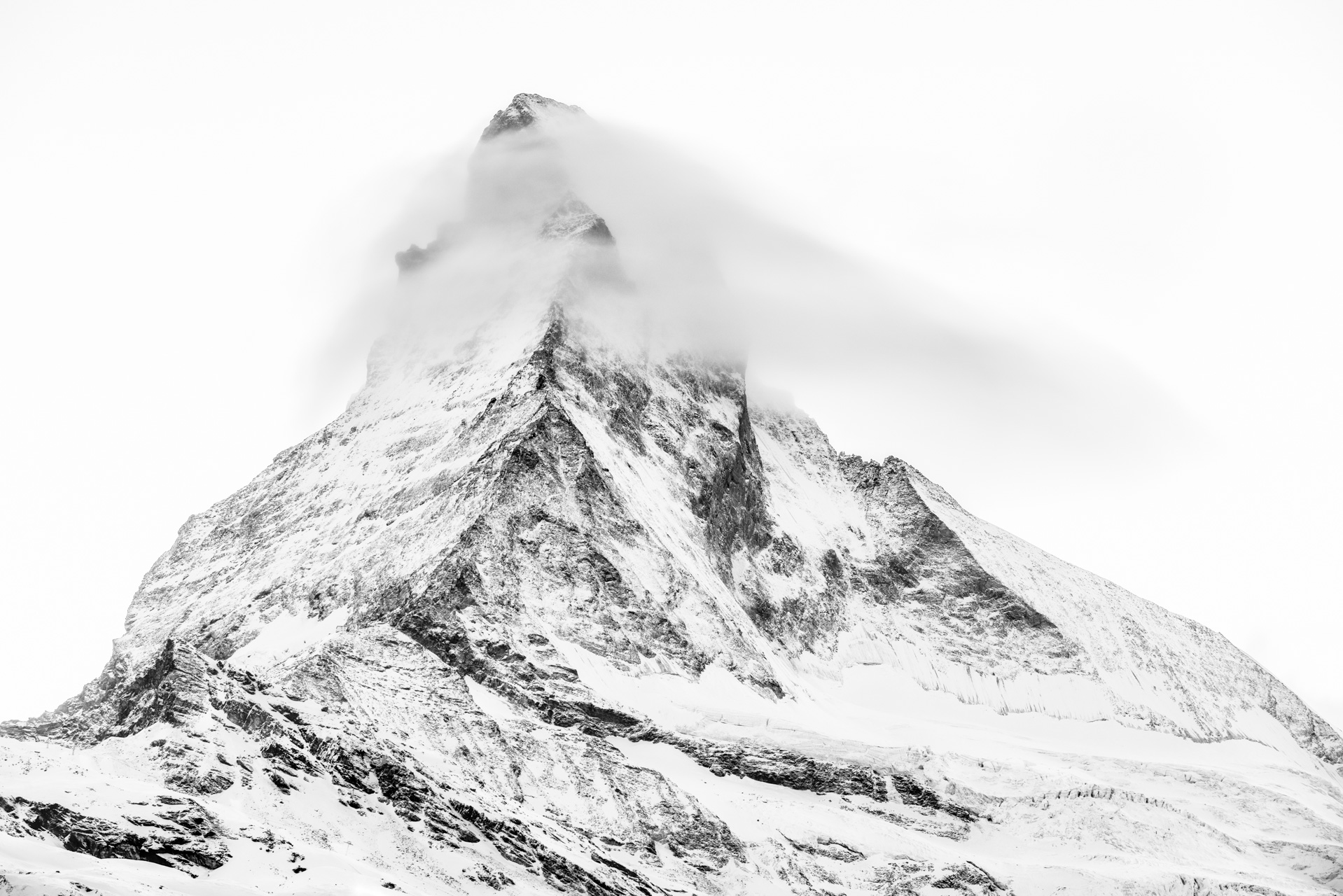
As you approach Zermatt, the Tufteren and Sunnegga mountain pastures set the scene; the Matterhorn rises, intangible, and the walk slows down of its own accord. You sit back, listen to the wind, let the mountain take up all the space. Pure contemplation: the best way to round off this journey among the peaks.